News


16 February 2026
Flying High: Civil and EEE Students of FET Experience Drone Surveying at Harohalli Hills
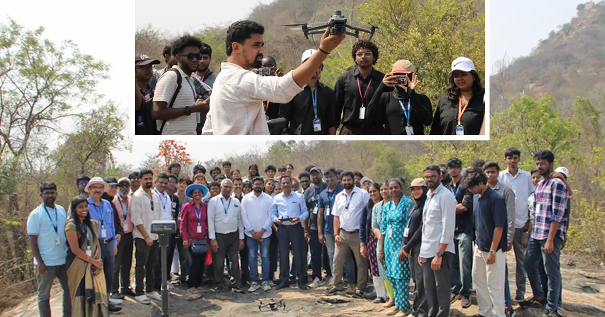
Harohalli, 16th February 2026: Students from the Departments of Civil Engineering and Electrical and Electronics Engineering (EEE), Faculty of Engineering and Technology, JAIN (Deemed-to-be University) recently participated in a hands-on site visit to Harohalli Hills on 16th February 2026, focusing on drone-based topographical surveying. The visit offered practical exposure to modern UAV technology, bridging classroom knowledge with real-world engineering applications.
Industry experts from Bibang & Karthik Drone Solutions conducted the technical sessions, demonstrating UAV operations, flight planning, data acquisition, and photogrammetric processing. Students learned to capture high-resolution aerial imagery, process it to generate orthomosaic images, and develop 3D models and contour maps for terrain analysis.
The visit also introduced first-year EEE students to the fundamentals of drone electronics, power management, GPS integration, and control systems, while Civil Engineering students gained hands-on experience in contour generation, Digital Elevation Models (DEM), and accurate terrain mapping for infrastructure planning.
The programme was graced by Shri Ravindra Bhandari and Dr Benaka Prasad, who encouraged students and engaged with industry specialists to discuss the latest trends in drone surveying. Students actively participated in interactive sessions, clarified doubts, and observed real-time drone operations on control monitors.
The varied topography of Harohalli Hills, with its rocky surfaces, natural vegetation, and elevation changes, provided an ideal environment for applying drone-based surveying techniques. Participants reported enhanced understanding of field challenges, teamwork, and technological integration in modern infrastructure projects.
The site visit demonstrated the university’s commitment to experiential learning and interdisciplinary education. By combining practical skills with industry insights, the initiative prepared students for professional readiness, reinforced problem-solving abilities, and offered a glimpse into emerging career opportunities in modern surveying and UAV applications.