News


12 April 2026
Charting Terrain with Drones: A Practical Journey into UAV Surveying and Mapping
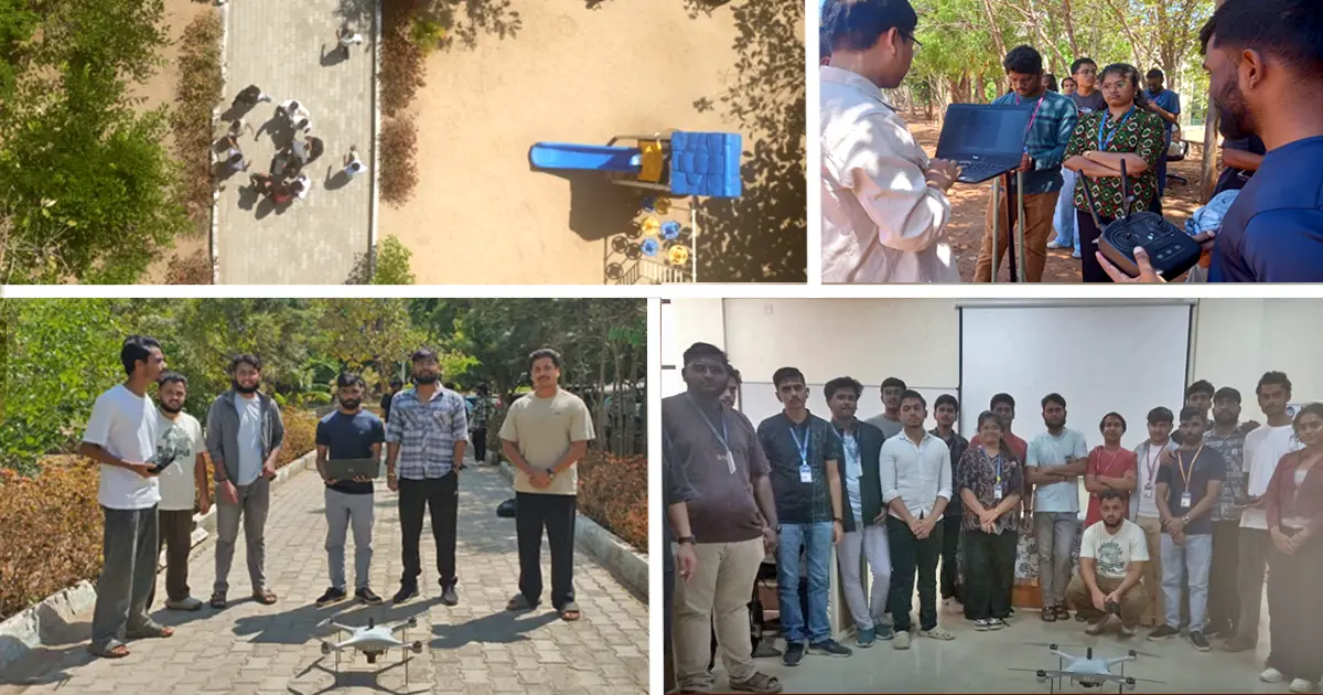
Bengaluru, 12th April 2026: Bridging classroom learning with emerging industry practices, the Department of Civil Engineering at JAIN (Deemed-to-be University), through its Atharva Club, organised a seven-day Value Added Program (VAP) on Drone Surveying Essentials: From Basic UAV Operations to Advanced Mapping Techniques from 6 to 12 April 2026. Conducted in collaboration with BK Drone Solutions, the programme offered students an immersive introduction to unmanned aerial vehicle (UAV) technology and its applications in modern surveying.
The programme brought together 32 students for a structured learning experience that combined online conceptual sessions with intensive on-ground training. It began with foundational topics, including drone fundamentals, flight dynamics, UAV applications, and regulatory frameworks, providing participants with a clear understanding of the technological and legal landscape.
As the sessions progressed offline, the focus shifted to hands-on learning. Students worked directly with trainer and professional drones, gaining familiarity with UAV components, operational software, and live flight procedures under expert supervision. Through guided exercises, participants performed a range of flight tasks and were assessed on predefined operational criteria, helping them build both technical competence and confidence.
A key highlight of the programme was its emphasis on real-world application. Industry-led demonstrations and case studies illustrated how drone technology is used in surveying and geospatial analysis. Students were also introduced to photogrammetry techniques, where they processed aerial data collected during field sessions to generate mapping outputs, linking data acquisition with analytical outcomes.
The final phase of the programme returned to an online format, focusing on doubt clarification, quizzes, and assignments to reinforce learning. The sessions were led by a team of experienced resource persons, including Mr. Bibang G B, Mr. Balachandan Shetty, Mr. Tejas S, Ms. Chaithra J R, Mr. Surya C L, Dr. Shwetha A, Dr. Nakul R, and Mr. Karthik M H.
By integrating theory, practice, and industry insight, the programme provided students with a comprehensive understanding of UAV-based surveying. It not only strengthened their technical skills but also prepared them for emerging opportunities in drone-enabled mapping and geospatial technologies, reflecting the department’s continued focus on industry-aligned education.